Your hub for all data and people
Investors, owners, architects, engineers, authorities and contractors – connect all your data and present it instantly to all stakeholders.
Trusted by major players in infrastructure and construction, our platform has been perfected over ten years of systematic development.
Infrastructure Projects
See the big picture
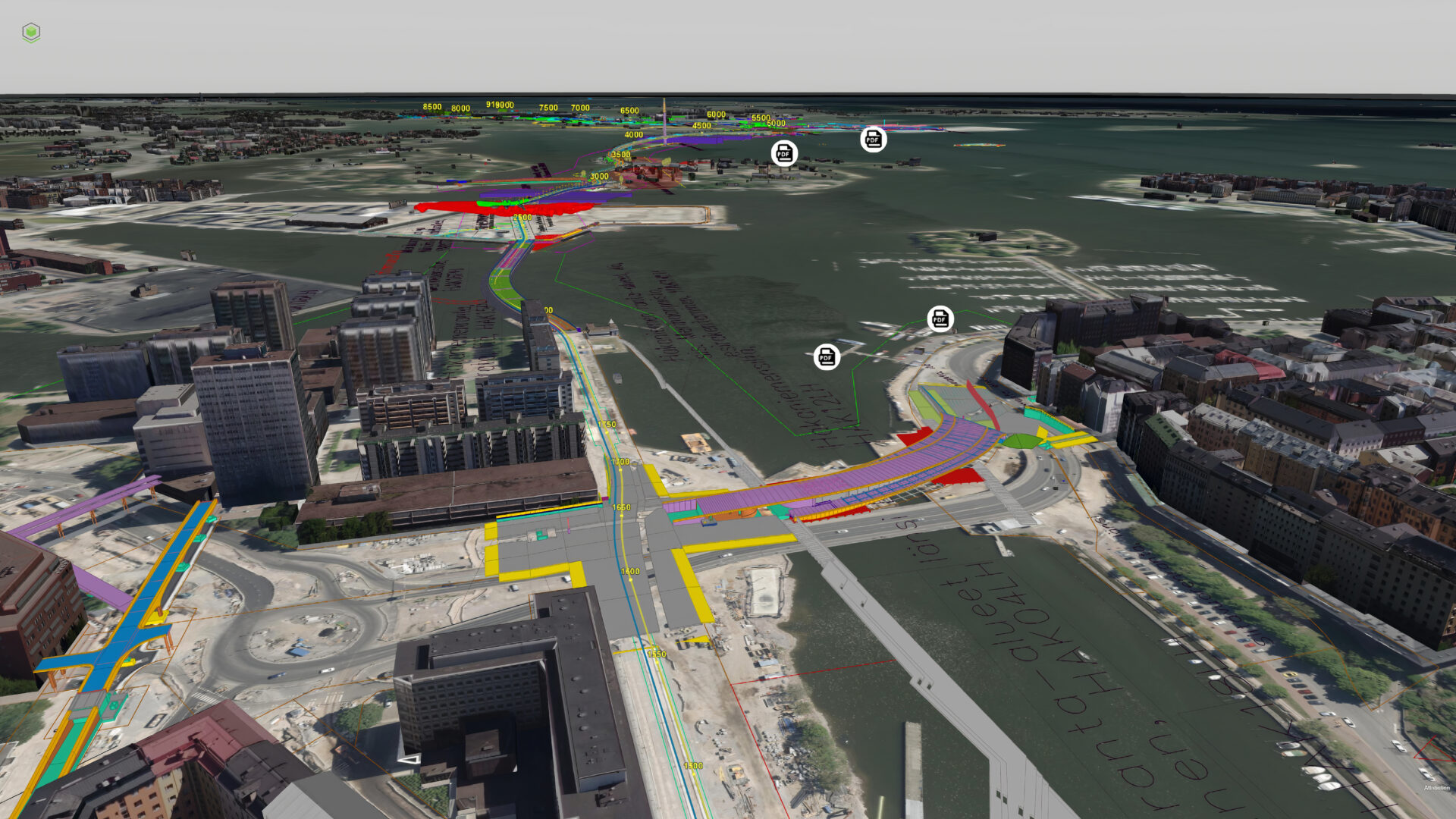
Combine all terrain, subsurface and ground-level elements of infrastructure projects into a single visual platform. Zoom from a birds-eye view to a single component in seconds. Review land mass and structure layers from a cross-section display. Access all data via a browser-based interface.
Area planning and zoning
Understand and illustrate the future
Understand the effects of planned construction. Illustrate future zoning plans and buildings on top of existing environments. Vektor.io supports all relevant coordinate systems and data formats from maps, point clouds, and infrastructure models to building information models and IoT data.
Design collaboration
Big data? No problem
Collaborate efficiently between stakeholders from different engineering disciplines. Enable smooth collaboration by combining all design data into a single platform. Vektor.io’s browser-based interface provides the same premium user experience regardless of project size or complexity.
Construction
Streamline your workflow
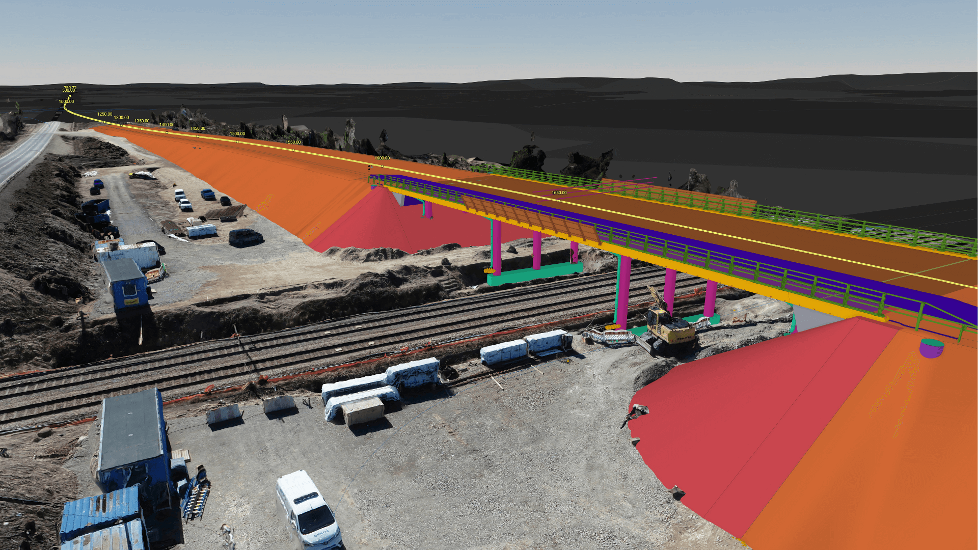
Avoid costly design mistakes before you execute. Combine all design disciplines and reality capture data into a single visual and data rich digital twin experience.
Facility Management & Operations
Introducing a new level of efficiency
Improve efficiency and profitability for buildings and infrastructure. Enable quick troubleshooting even at a building or single machine level. Build a digital twin that stores different operational information and analyze systemic faults.
Total solution for digital twin viewing and interaction
Vektor.io provides user-friendly and lightning-fast tools for visualizing and exploring BIM and GIS data for all stakeholders.
Infrastructure owners
Get what you pay for. Better quotes and less deviation thanks to high-quality data and modeling. | |
Your models travel with you. Thanks to our mobile-optimized interface you can access all your data anywhere and at any time. Provide up-to-date status and awareness for all stakeholders throughout the project. | |
Simplify your workflow. Vektorio.io is your all-in-one solution for all BIM and GIS needs. |
Contractors
Faster construction with less deviation through more detailed quotes and premium data modeling. | |
Put yourself on the map. Your models are available anywhere and at any time in your mobile device. | |
Streamlined user interface and the same intuitive user experience on any platform or device. |
BIM Coordinators and Designers
Navigate quickly between projects with lightning-fast loading times, find what you need in an instant with quick Search & Filter functionalities. | |
Test-line feature for infrastructure projects. | |
Unrivaled ease of use, market-leading format support, plus quick and easy data pinpointing. |
Are you ready to meet the future of smart infrastructure?
Book a product demo or ask for pricing.