Finnish Laakso Hospital
Finnish Laakso Joint Hospital Construction Project: Utilizing Photogrammetry for Real-time Project Insights
5.12.2023
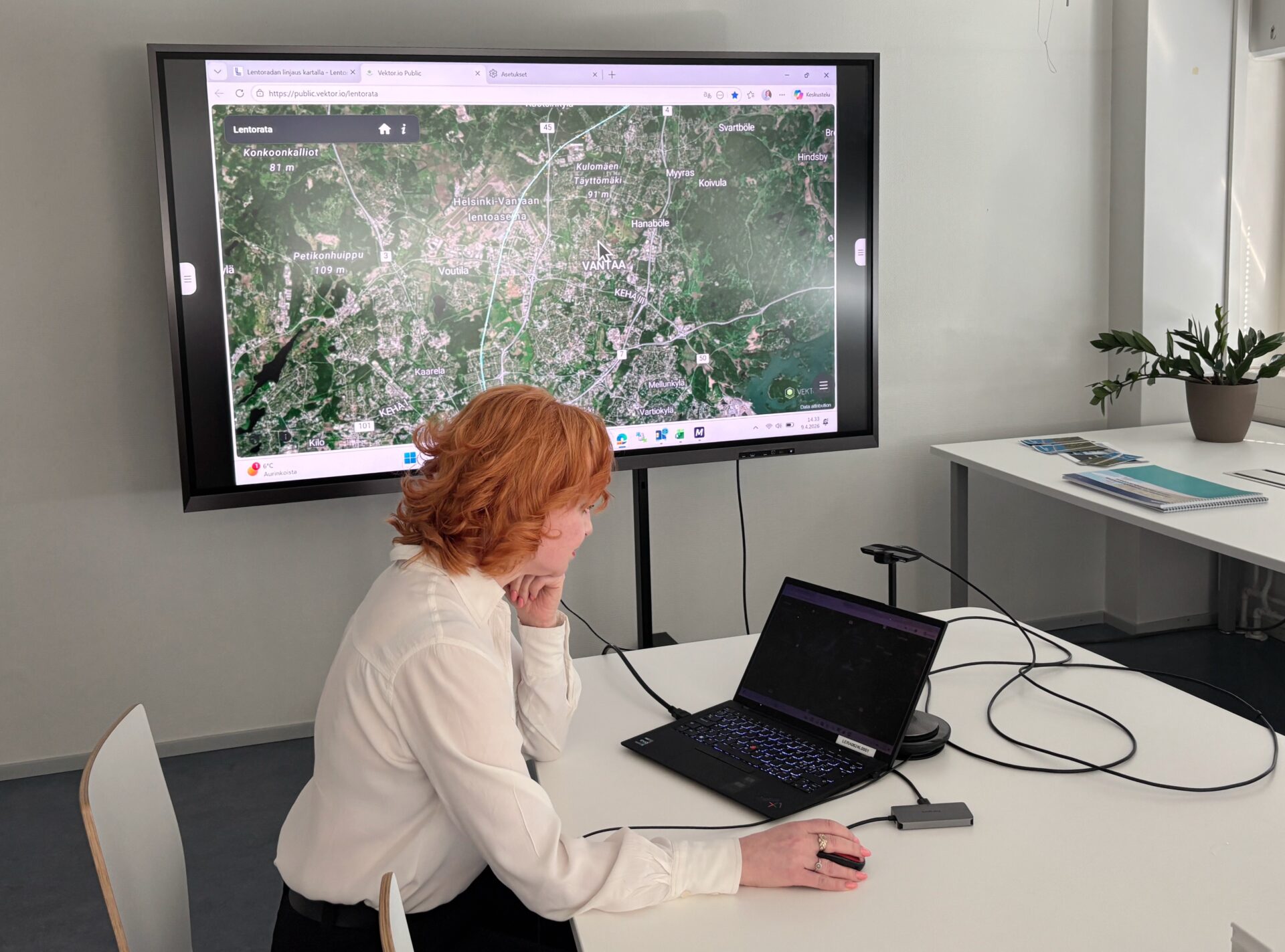
The City of Helsinki and Helsinki University Hospital (HUS) are undertaking the renovation of the Laakso hospital area from 2022 to 2030. According to Tatu Kallas, the Measurement Manager at Destia, the Vektor.io software has proven to be an exceptional tool in the construction project, facilitating the efficient visualization of photogrammetry data generated by drones.
The Laakso Joint Hospital, a collaborative project initiated by the Laakso Joint Hospital Alliance, aims to construct the best possible hospital for patients, clients, employees, as well as for research and educational purposes in the future. Photogrammetry, an efficient visualizing method utilizing thousands of photos taken from various angles, plays a crucial role in this endeavor.
“The surveys are conducted approximately every week or two, considering the necessity and weather conditions. Before each flight, a flight plan is devised, detailing the area to be photographed, flight speed, altitude, and photography angle,” explains Measurement Manager Tatu Kallas from Destia.
Most settings are automated, with capture frequency being a vital factor for accuracy. Closer pictures to the targets enhance the end result, and the recommended altitude is approximately 50 meters. The imaging can occur at a 70-degree camera angle, allowing for diverse perspectives and better recording of terrain features.
Kallas emphasizes the speed of the imaging process, stating:
“In an hour, a substantial data area (approximately 25 hectares) can be collected, provided that the flight plan and signal points are meticulously prepared.”
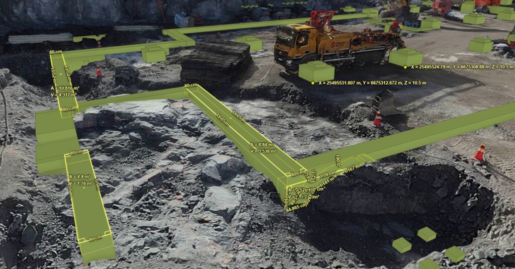
To achieve the best results, it is recommended to place signal points strategically throughout the area and at its corners. Ground control points have proven effective, significantly improving the accuracy of the model’s elevation position, according to Kallas.
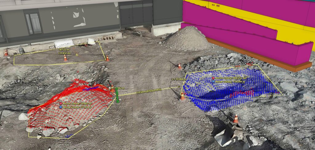
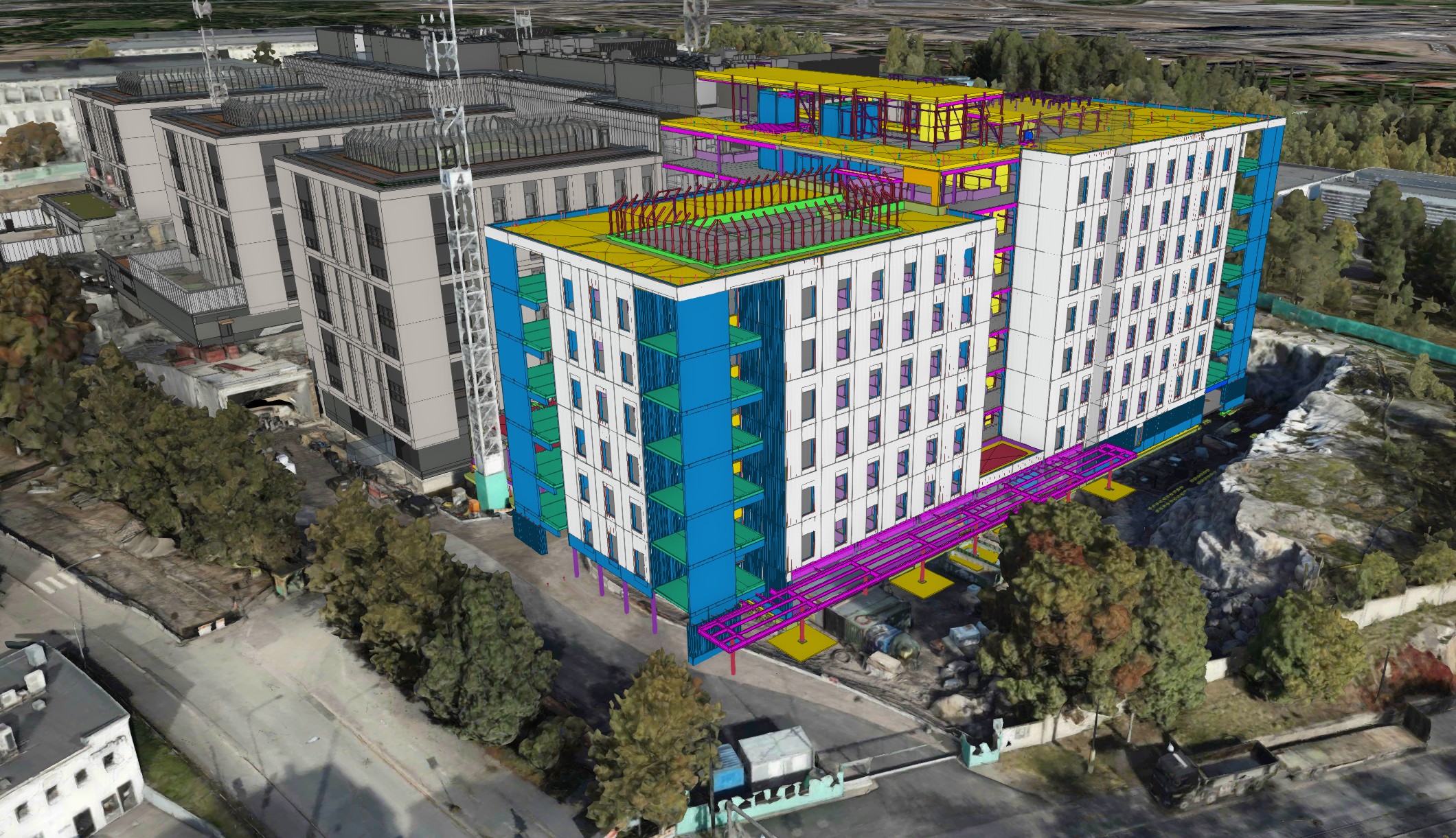
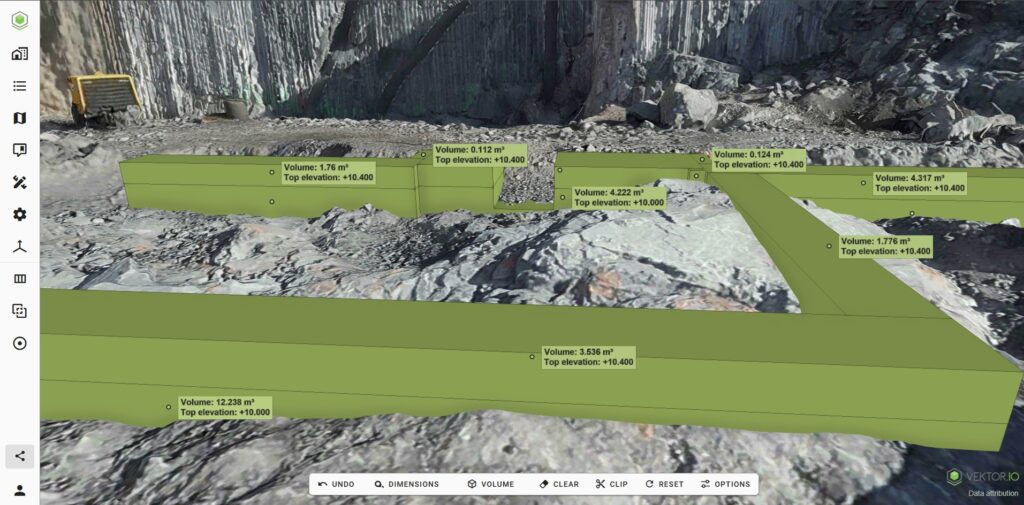
The photogrammetry data serves as a current situational overview for the project, aiding in reviewing plans with high visual and location accuracy. It is also valuable for monitoring production progress and job planning.
Kallas notes the positive reception of the software, stating:
“A current 3D situational overview enhances job planning and eliminates the need for separate location inspections. The software is widely used across various organizations within the project, including project managers, surveyors, site managers, area planners, schedule planners, geospatial designers, and design control.”
The Vektor.io software has proven to be indispensable in the project, particularly due to its photogrammetry features.
“The benefit provided by photogrammetry data has been a key factor in achieving widespread use of the Vektor.io software among various stakeholders in the project,” adds Kallas. The software has established itself as a crucial tool, enhancing site planning and phasing while supporting the overall smooth progress of the project.