Colas
Colas integrates Vektor.io into its 2IN territorial digital twin platform
6.5.2026
Colas has integrated Vektor.io into its 2IN territorial digital twin platform to bring point-cloud capabilities into the same environment where teams already access geospatial and project data.
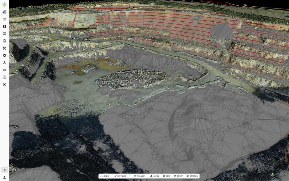
Through the integration, teams can open point-cloud datasets, compare them with CAD or BIM models, and calculate volumes directly within the 2IN platform.
A digital twin platform for Colas territories and infrastructure
2IN is Colas’ territorial digital twin. It leverages big data, GIS, and BIM technologies to integrate and correlate internal and external datasets that support the company’s construction projects and industrial processes.
The platform was originally designed to archive and leverage Colas’ geotechnical and as-built datasets. Over time, it has evolved into a shared environment where teams can access project-related information through a single interface capable of visualizing more than 60 different file formats.
Today, 2IN is accessible to employees across Colas. According to internal figures, the platform currently serves around 3,200 users in 32 countries, with tens of thousands of shared files and more than one hundred open data layers integrated into the system.
Maintaining independence and ensuring full data sovereignty is strategically essential for Colas.
Bringing point-cloud capabilities into the 2IN platform
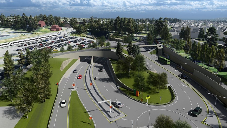
Teams working on quarries and construction projects often handle point-cloud datasets captured through scanning technologies.
To support these workflows within the 2IN platform, Colas integrated Vektor.io. The integration was proposed to add capabilities for opening point-cloud datasets, comparing them with CAD or BIM models, and performing volume calculations.
The first users of this capability are expected to be teams working on quarries or construction projects who regularly work with point-cloud data.
As Pierre Marechal from Colas explains:
“2IN is Colas’ territorial digital twin, created to leverage internal data with full sovereignty and now strengthened by Vektor.io, which brings powerful point-cloud visualization, CAD/BIM comparison, multi-format support, and volume calculation capabilities—an integration initiated to benefit quarry and project teams.”
Why Vektor.io was selected
Vektor.io was selected to extend the capabilities of the 2IN platform for working with point-cloud data.
The solution allows users to:
- Open point-cloud datasets
- Compare point clouds with CAD or BIM models
- Calculate volumes based on point-cloud data
Several factors contributed to the decision. According to Colas, Vektor.io stood out due to:
- The diversity of file formats it supports
- Its open BIM philosophy
- Its API, which enables integration with platforms such as 2IN
These capabilities allow point-cloud data to be accessed and compared with design models directly within the platform.
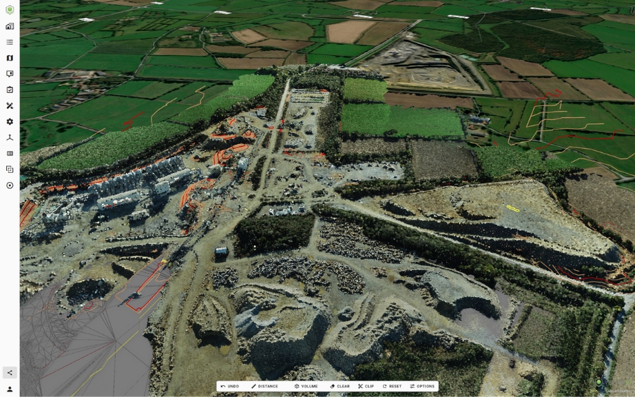
Practical example: working with point-cloud data in quarries and construction projects
Teams working on quarries and construction projects often work with point-cloud datasets captured through scanning technologies.
With the Vektor.io integration, these datasets can be opened directly through the 2IN platform and compared with design models.
For example, teams can:
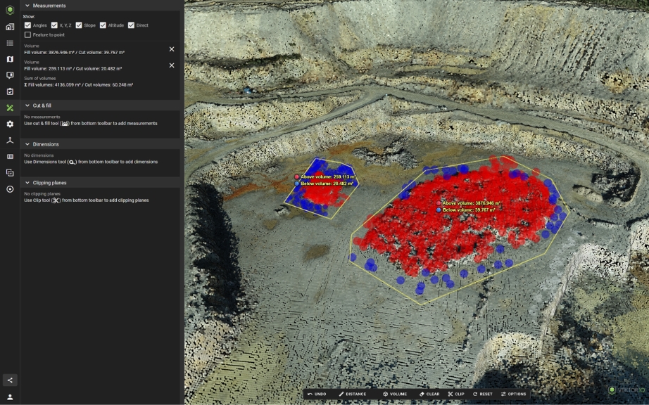
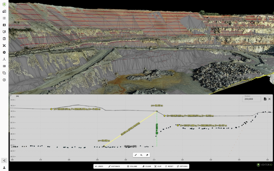
- Visualize point-cloud data captured on a quarry or construction site
- Compare the point cloud with a CAD or BIM model
- Calculate volumes based on point-cloud data
These capabilities allow teams handling point-cloud data to access and work with it directly within the 2IN platform.
Key outcomes
- Point-cloud capabilities added to the 2IN platform
- Ability to open and visualize point-cloud datasets
- Comparison between point clouds and CAD or BIM models
- Volume calculations based on point-cloud data
- Support for a wide range of file formats