
Vektor.io’s First Global Webinar – Recording & Resources
27.08.2025
Vektor.io’s first global webinar demonstrated how complex project data can become clear, actionable, and easy to use – directly in the browser.
In this 45-minute session (in English), we showcased Vektor.io’s core features and real use cases from infrastructure and construction projects. Participants saw how BIM models, GIS data, and survey data including photogrammetry and point clouds can be combined into one intuitive platform that works seamlessly on any device.
Key Takeaways:
BIM meets reality
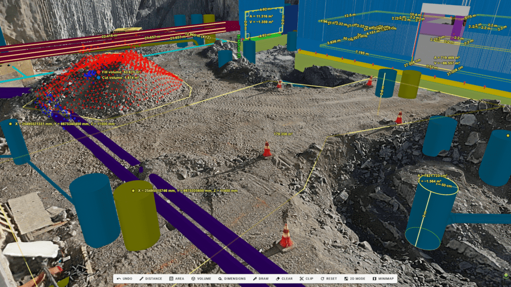
How to integrate BIM and survey data such as photogrammetry and point clouds for easy access by all stakeholders in a construction project
You can’t manage what you can’t measure
How to get more value from BIM models and survey data with advanced measurement and quantity takeoff tools.
Forget 2D drawings
How to create cross-sections freely from any BIM models, Point Clouds and Photogrammetry, enabling precise measurements and insights.
Whether you’re new to Vektor.io or already using it in your projects, this webinar is designed for professionals in construction projects who want to simplify data access, enhance collaboration, and take project management to the next level.
Want to watch the recording?
Fill in the form below — the video will open immediately after you submit your details.
"*" indicates required fields
Read more news
New in Vektor.io
25.6.2025
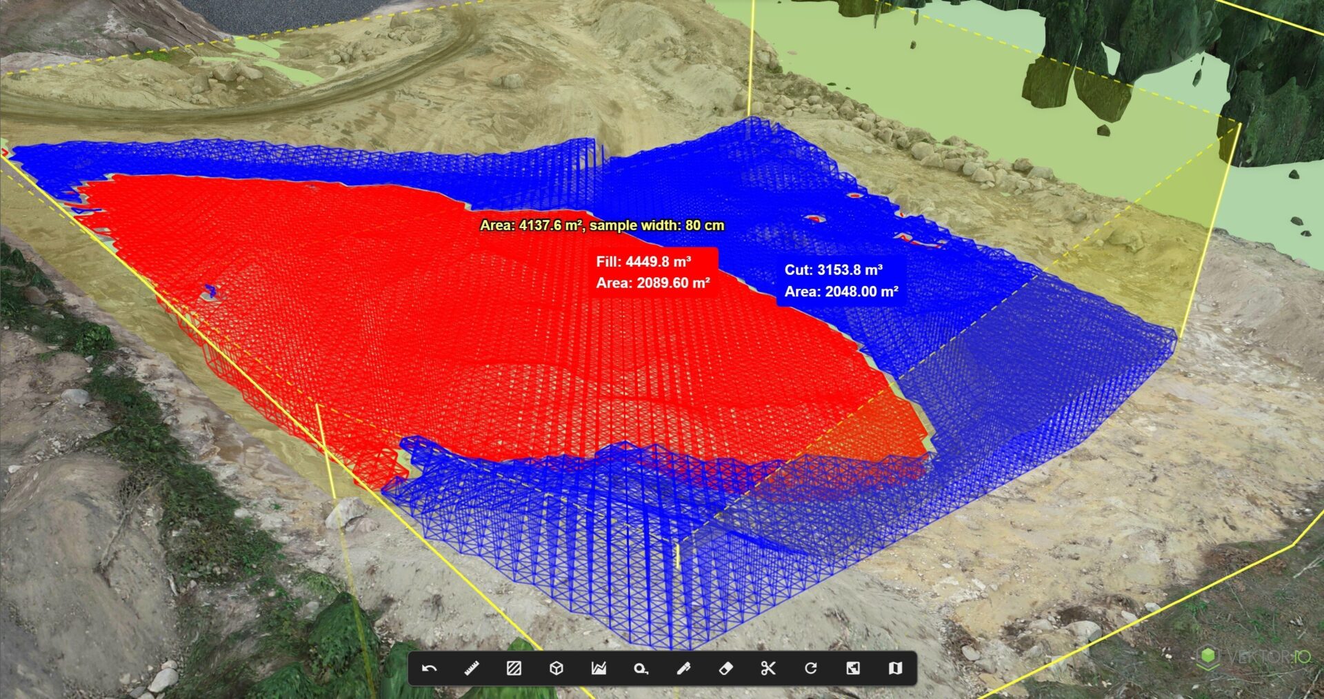
Cut and Fill Volume calculation – Now Accessible to the Whole Project Team, Right in the Browser
We’ve released a new Cut & Fill Volume Calculation tool in Vektor.io – a fast,…
Event
13.8.2025
Meet Vektor.io at Intergeo 2025
We’ll be in Frankfurt, Germany, October 7-9 at the world’s leading event for geodesy, geoinformation…

News
11.8.2025
Vektor.io Contributing to the Development of Vantaa Light Rail – Advanced Information Modeling Tool Enables Streamlined Planning and Execution
Vektor.io’s information modeling tool has been selected to support the development of the Vantaa light…